
Crondall Water Situation
A guide to the key issues, on this page:
- The 4 water systems of Crondall
- Crondall Flood Action Group (CFAG) and Activities
- Riparian Responsibility
- Hart Flood Forum and Associated Activities
- Thames Water Activities
- Environment Agency Activities
- Hampshire County Council (HCC) Highways Activities
The 4 water systems of Crondall
There are 4 main water “systems” in Crondall:-
- River Hart (including upstream tributaries) nominally managed by the Environment Agency.
- Surface Water Drainage, usually managed by Hampshire Country Council (HCC) highways, BUT “Riparian” responsibilities apply to many landowners
- Ground Water. This includes the deep “aquifers” (protected by the Environment Agency) and shallow “perched” water (locally managed where it appears)
- Sewer System. Linking most houses in the main village area to the Sewage Treatment works behind Handcroft Close. The entire system is managed by Thames Water.
This guide to flooding in Crondall doesn’t consider water “supply” (via South East Water). There have been numerous broken supply pipe problems generally attributed to differential settling of the road under more regular and heavier vehicles and old (brittle) pipes. Supply-side leaks should be reported via South East Water, details on the South East Water website or by telephone on 0333 000 0365.

Riparian Responsibility
If you own land or property next to a river, stream or ditch you are a ‘riparian landowner’ and this document EA Living on The Edge Jun 2013 has been produced to explain your responsibilities. Please take a moment to read it.
In General: everyone with land adjoining the river (or its feeder streams) needs to ensure these are kept clear of debris and vegetation. Vegetation and grass clippings etc. should NOT be dumped in the stream – the rotting process removes oxygen from the water and kills the wildlife. A “healthy” stream tends to look after itself and doesn’t smell! But the big risk is debris: during high water levels, this can get swept off and catch on other bridges etc. to form a barrier. At peak flows within its banks, the river Hart is flowing at 600Litres/second! So water levels can very quickly build up as they did in 2006 (tbc).
Pond clearance: It’s important that people take responsibility for their areas of Riparian management and work with neighbours where help is needed or the job is shared. A fantastic example of this was the recent (Sept 2014) Well Road Pond Clearance Sept 2014. Residents clubbed together to organise the dredging (and the associated Environment Agency licence – everything has paperwork these days!). The Parish Council contributed to the cost and the job was done very efficiently by a local contractor. Just to be clear, you don’t need a licence for minor works along your piece of riverbank. If there’s any doubt please ask.
Hart Flood Forum and Associated Activities
The Hart Flood Forum was convened by Cllr Crookes to draw together the affected Parishes (Crondall is not alone: Odiham and Dogmersfield also have significant issues) with the main authorities: the Environment Agency (EA), Thames Water (TW), Hart District Council (HDC), and Hampshire County Council (HCC) Highways.
The Forum meets quarterly and helps to draw together and share Parish experiences, solutions and issues. The arrangement also helps to set actions and assert a little more pressure than might be achieved in a standalone capacity. However, we must remain aware that the Forum is voluntary for the participants and hence persuasion is the order of the day.
Thames Water Activities
Thames Water is responsible for the Sewer system in Crondall. Crondall was placed on “mains” sewage in the 1950s, with most houses connecting up over the years. The sewer drains to a “pool” and pumping station on Pankridge Street, from where it’s pumped up to a standalone treatment works behind Handcroft Close. The processed discharge is then returned to the River Hart.
During winter 2013/14, the sewer became overfilled (“inundated”) with ground/perched water ingress causing back-flooding for various houses. The usual effect was for sewage to leak from unsealed manholes into front gardens and then percolate under shallow (and ancient) foundations.
Thames Water learnt a lot from the events of that winter (2013/14) and now have more robust contingency plans in place. But they have also been active and highly cooperative with the Hart Flood Forum and CFAG to work over the summer to identify the causes and fix/mitigate them. It’s a challenging task, as Crondall is not at such high risk (combining probability and impact) as some other areas of the Thames Water area. The harsh reality is that resources will go to where they’re needed most. BUT, CFAG has maintained pressure and together with Thames Water there have been some successes:-
- Several walkabouts of the village to identify trouble spots
- A high pressure cleaning of the main sewer
- Camera survey of the main sewer (its cast iron and in good condition, even for its age!)
- A high-accuracy survey of high-risk houses to determine their suitability for Non-Return valves
- Specific repairs to issues noted by camera and walkabouts to minimise ground/perched water ingress into the system
- Fitting of new “impellers” to the pumps to make them les prone to “ragging” (the collection of rags and other materials on the impeller reducing its efficiency)
- Development of an improved model to help identify the trouble spots
- Planned installation of a depth monitor to improve the accuracy of the modelling
Also see Thames Water website
Environment Agency Activities
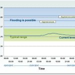
The Environment Agency (EA) has installed Water Level Monitors at 2 locations (the links take you to the EA website):
These monitors provide a standalone warning service to registered users. If you go to theRedlands Lane example EA website (Flood Warnings Direct) then you can register to have text, voice or e-mail warnings of high water levels in the River Hart. The system is relatively simple and triggers the warnings once a threshold level has passed, BUT the EA are considering removing this due to low sign-up rates, so please take a moment to register.
Incident reporting. As we try to make better sense of the wide range of flood risks that we face, we have tried to ensure that any flood events are properly recorded. This is of great benefit to the modelling teams (operated by EA and TW).
Hampshire County Council (HCC) Highways Activities
To be completed